


LanDTM
version 6.1.6 |  windows
windows
Name: LanDTM
Version: 6.1.6
Size: 31.73 MB
Category: 3D Modeling & CAD
License: Free
Released: 2012-02-15
Developer:
Downloads: 1014
Version: 6.1.6
Size: 31.73 MB
Category: 3D Modeling & CAD
License: Free
Released: 2012-02-15
Developer:
Downloads: 1014
| Rate this software: |

zip | 31.73 MB
Description
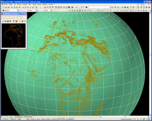
The program runs on Autocad 2007/2008/2009 32bits, Autocad 2010/2011 32bits, Autocad 2008/2009 64bits, Autocad 2010/2011 64bits, BricsCAD v10/v11.Geographical information.- You can draw the DTM of all the world, because the program is compatible with SRTM format and it download the files by you and draws the result.
Professional.- It's not only a program to calculate a delaunay triangulation but you can insert break-lines to get a representation of the real terrain.
History.- The first version of this program came onto the market in 1992 and there are more of 3000 professionals working with it, civil engineers, architects, foreman builders, surveyors, mathematics, etc.
Quick, Unlimit points and reliable.- I've tried the program with 1000000 of points and It had'nt problems to calculate the triangulation. The program is more slow when you have too many break-lines, (more of 20000).
Flexibility.- Usually, the programs have tools to edit, on the drawing the calculated triangulation. This is good because you see the modifications in real time. LanDTM has these tools, 'insert line', 'change edge', 'insert point', 'delete triangle', etc, which they are in a Tool Bar easy to handle. The contouring and triangulation are drawn again while you use these tools.
But, that's not all, given the best feature of LanDTM is that you can exit the program and to edit the triangulation lines like you want with all the power of the CAD edition tools.
Multitask.- You can open until five instances of the program and work with a different DTM in each. Only, write "LanDTM" on the command line and you'll see other 'LanDTM' window.
Volume calculation.- You can calculate the volume between two DTMs. There are two ways to get it.
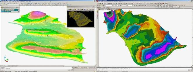
Fill and cut.- With the volume calculation, the resulting points have, as elevation, the elevation difference between each models with you create them. So, we can draw CAD solids, "SOLID", with differents colours so that they show us the fill and cut zones.
Screenshots
Similar Software
AutoCAD Table - { Cadig TableBar 2.4 } KLONK Image Measurement Visual Terrain Maker Faceworx Sculptris FrameXpert Frame Designer 4.1.3Sweet Home 3D 5.2Ra Workshop Ultra Lite 3.3.1CadFaster QuickStep 2009 3DVIA Shape Beta 2.0Inkscape DWG FastView - 64bit 2.5 - 64bitnanoCAD 3.5EWD 3D 5.6.7LiteCAD 2.0.0.48


